Asahikawa to Furano Ultra Walking
65km via Biei, Hokkaido/Experience Hokkaido's Most Scenic Route
What is the Lavender Road Ultra Walking Event?
The 65km Asahikawa to Furano Ultra Walking offers an extraordinary journey through Hokkaido's most iconic landscapes—from Asahikawa's urban gateway through Biei's world-famous rolling hills to Furano's legendary lavender fields...
Event Overview & Key Information
Distance: 65km
Time Limit: 13.5 hours (with checkpoints)
Location: Hokkaido, Japan (Asahikawa City / Biei Town / Kamifurano Town / Nakafurano Town / Furano City)
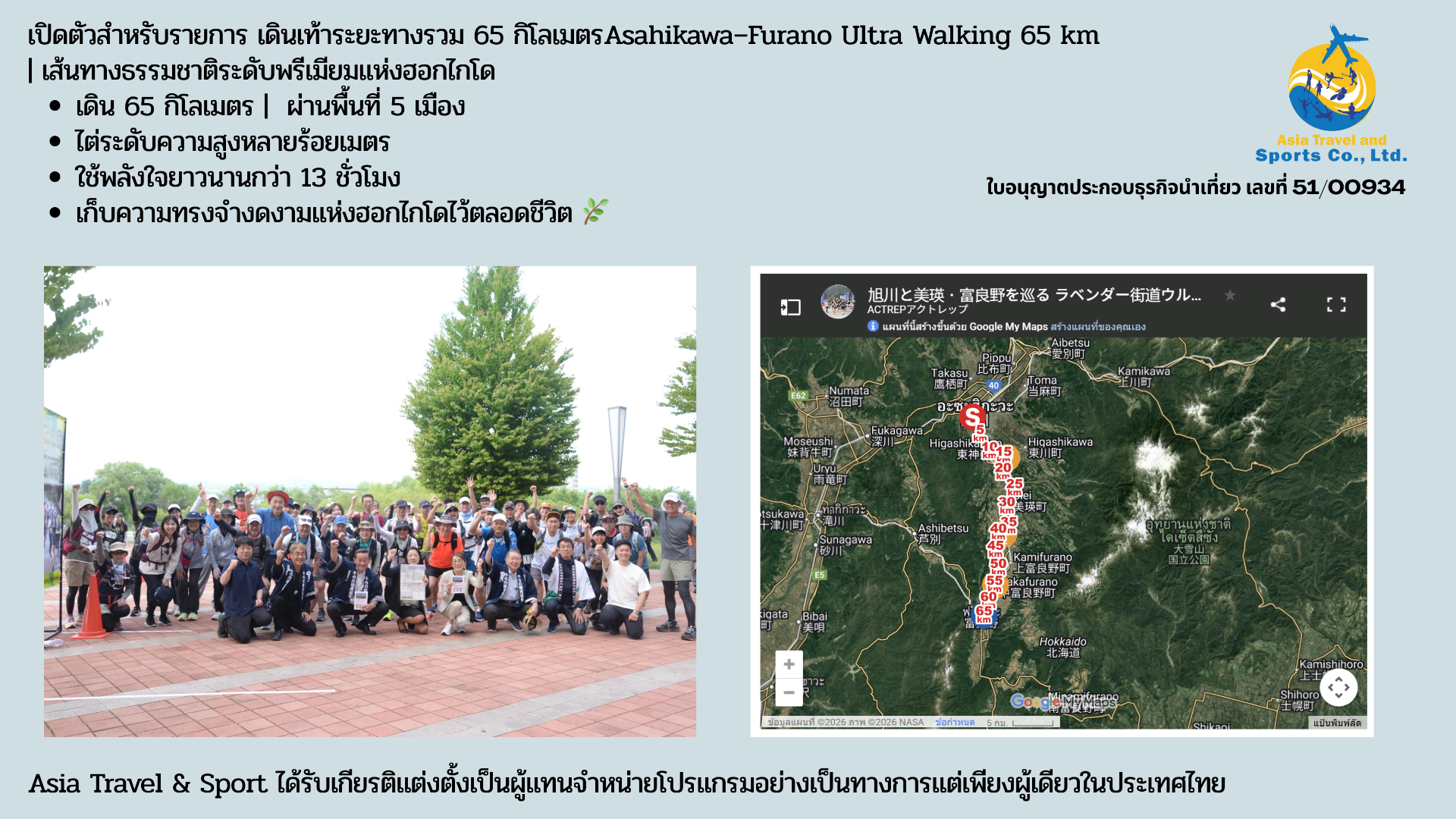
Capacity: 300 participants (First edition: approximately 170 participants)

Who Can Participate? Eligibility Requirements
Age Requirements
- Junior high school students and above
- Participants under 20 must obtain parental consent
- Junior high 3rd grade and younger must be accompanied by parent/guardian for entire course
Health Requirements
- Must be in good health
- Those with chronic conditions or taking medication must obtain medical consent
- Participants with mobility impairments must arrange their own caregiver
General Requirements
- Must comply with event regulations and traffic laws
- No refunds after registration
The 65km Route: What to Expect
Terrain: Mostly flat, urban to suburban transition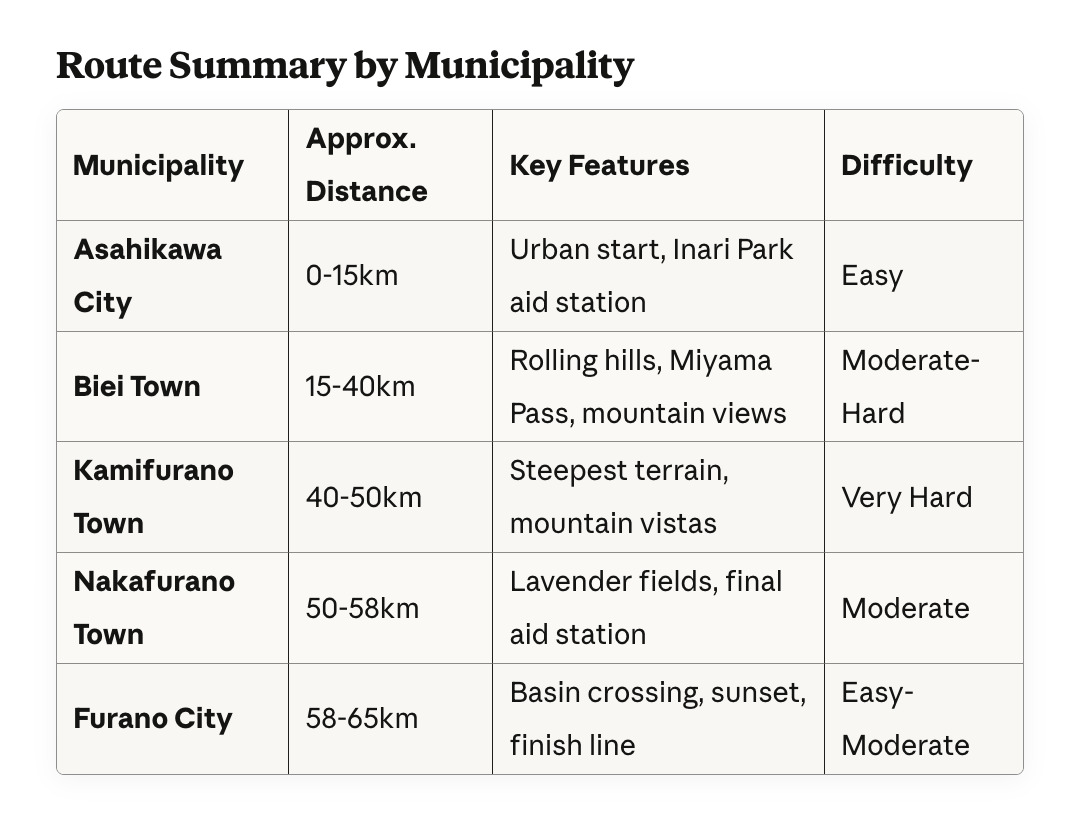
Follow the scenic journey from Asahikawa to Furano, passing through five municipalities along the famous Lavender Road.
Stage 1: Asahikawa City - Urban Start (0-15km)
Start Point: JR Asahikawa Station (7:00 AM)
Begin your adventure in Hokkaido's second-largest city. Departing from the central JR Asahikawa Station, you'll walk through urban streets transitioning into rural landscapes.
Key Landmarks:
- JR Asahikawa Station (Start)
- Asahikawa Airport vicinity (Hokkaido's second gateway)
- Entry to the Lavender Road
Expected Time: 2-3 hours
First Aid Station: Inari Park (Asahikawa)
Distance: Approximately 15km from start
Located at Inari Shrine, this first checkpoint provides essential refueling before entering the hill country.
Available:
- Rice balls (onigiri)
- Hydration stations
- Basic medical support
- Rest facilities
Stage 2: Asahikawa to Biei Town - Entering Hill Country (15-35km)
Transition Zone
As you leave Asahikawa city limits, the landscape transforms dramatically. Rolling agricultural fields and gentle hills mark your entry into one of Hokkaido's most photographed regions.
Highlights:
- Gradual elevation gain begins
- Views of patchwork farm fields
- First glimpses of distant mountain ranges
- Transition from urban to rural scenery
Terrain: Rolling hills, moderate inclines
Expected Time: 3-4 hours from Inari Park
Stage 3: Biei Town - The Scenic Heart (20-35km)
Biei Town Overview
Welcome to the "Hill Town"—famous worldwide for its picturesque rolling landscapes and seasonal color contrasts. This agricultural area features geometric patterns of various crops creating a patchwork quilt effect across undulating terrain.
What Makes Biei Special:
- Rolling hills formed over millions of years
- Patchwork fields of wheat, potatoes, and flowers
- Dramatic seasonal colors (late June: fresh green with early lavender)
- Photography paradise with iconic viewpoints
- Gentle to moderate elevation changes
Terrain in Biei: Challenging rolling hills with continuous ups and downs
Expected Time: 3-4 hours through Biei
Difficulty: Moderate - scenic but physically demanding
Notable Landmarks:
- Patchwork Road (panoramic farming landscapes)
- Scenic overlooks with mountain backdrops
- Traditional Hokkaido farmhouses
- Flower fields beginning to bloom
Stage 4: Kamifurano Town - Mountain Vista & Mid-Point (35-50km)
Kamifurano Town Overview
Entering Kamifurano Town, you reach the geographical and physical midpoint of your journey. This town serves as the gateway to the Tokachi mountain range, offering spectacular views of Hokkaido's "Roof."
What Makes Kamifurano Special:
- Gateway to Tokachi mountain range
- Views of Mt. Asahidake (2,291m - Hokkaido's highest peak)
- "Roof of Hokkaido" panoramic vistas
- Miyama Pass - highest elevation point on route
- Mountain resort atmosphere
Second Aid Station: Café YAMAICHI at Miyama Pass (Kamifurano)
Distance: Approximately 35-40km from start
Expected Arrival: 12:00-2:00 PM
This critical mid-point checkpoint offers substantial refreshments and the best mountain views on the entire route.
Featured Refreshments:
- Special curry (hearty meal for energy restoration)
- Local drinks and beverages
- Comfortable rest area with seating
- Extended break recommended (20-30 minutes)
Photo Opportunity: This is your best viewpoint for Mt. Asahidake and the Tokachi mountain range—don't forget your camera!
Strategic Importance:
- Halfway point physically and mentally
- Last substantial meal before final push
- Critical refueling and rest opportunity
- Psychological boost from mountain scenery
The Toughest Section: Post-Miyama Pass Challenge
After leaving Café YAMAICHI, the route continues through Kamifurano with relentless elevation changes. This is where mental and physical endurance are truly tested.
Kamifurano's Challenging Terrain:
- Steep ups and downs immediately after aid station
- Continuous elevation changes
- Most physically demanding section of entire route
- Fatigue typically sets in during this stretch
- Stunning mountain backdrops as reward for effort
Terrain: Steep ups and downs, most physically demanding section
Expected Time: 2.5-3.5 hours from Miyama Pass to Nakafurano
Mental Challenge: Very High - maintain focus and pacing
Distance in Kamifurano: Approximately 15km of challenging terrain
Tips for This Section:
- Pace yourself conservatively after leaving Café YAMAICHI
- Take short walking breaks as needed (don't push too hard)
- Stay well-hydrated (drink before you feel thirsty)
- Focus on one hill at a time (break it into micro-goals)
- Remember: This is the hardest section—it gets easier after
- Use mountain views as motivation during climbs
Stage 5: Nakafurano Town - Lavender Country (50-58km)
The Flower Town
Descending into Nakafurano, you enter the heart of Hokkaido's lavender region. This town is synonymous with lavender cultivation and home to the legendary Farm Tomita.
Nakafurano Highlights:
- Center of Hokkaido's lavender industry
- Farm Tomita - "Holy Land of Lavender"
- Flower fields in early bloom (late June)
- More gentle, rolling terrain
- Sense of approaching finish line
Final Aid Station: Hokusei Lavender Garden (Nakafurano)
Distance: Approximately 55-58km from start
Expected Arrival: 4:00-6:00 PM
This is your last chance for support before the final push. The refreshments here are designed to provide a morale boost and final energy surge.
Featured Refreshments:
- Hokkaido soft-serve ice cream (local specialty)
- Sake-kasu manju (sake lees sweet buns)
- Energy drinks and water
- Light snacks
- Medical check available
Psychological Importance: Only 7-10km remaining—the finish is within reach!
Stage 6: Furano City - The Final Push (58-65km)
Furano Basin Crossing
The route descends from the hills into the Furano Basin. As evening approaches, you'll experience one of Hokkaido's most beautiful sunsets over the Yubari Mountains.
Furano City - "Hokkaido's Belly Button"
Located at the geographical center of Hokkaido, Furano is famous for:
- Lavender fields and flower tourism
- Furano Wine (local grape cultivation)
- Ski resorts (winter season)
- Setting for popular Japanese TV dramas
Final Section Features:
- Gradual descent into city center
- Furano Basin flatlands
- Sunset over Yubari Mountains (weather permitting)
- Urban return as you approach the station
- Growing excitement as landmarks become familiar
Terrain: Mostly downhill and flat
Expected Time: 1.5-2 hours
Mental State: Tired but triumphant!
Finish: JR Furano Station
Arrival Time: Between 6:00-8:30 PM (depending on pace)
Cross the finish line at JR Furano Station to complete your 65km journey through five municipalities and some of Hokkaido's most stunning landscapes.
Welcome Celebration:
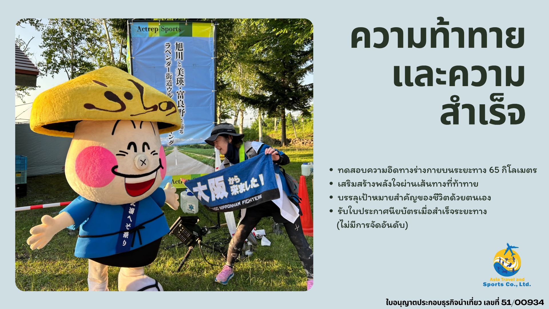
- Hesomaru-kun (Furano's mascot) greets all finishers
- Complimentary Furano Wine - made from local grapes
- Furano original Grape juice - non-alcoholic alternative from same grapes
- Certificate of Completion - official documentation of achievement
- Celebration atmosphere with fellow walkers
What You've Accomplished:
- 65 kilometers on foot
- Five municipalities traversed
- Hundreds of meters of elevation gain
- 13+ hours of determination
- Unforgettable memories of Hokkaido's beauty
Why Join the Lavender Road Ultra Walking?
Natural Beauty & Scenic Highlights
- Biei's Rolling Hills: Lush green landscapes with dramatic seasonal contrasts
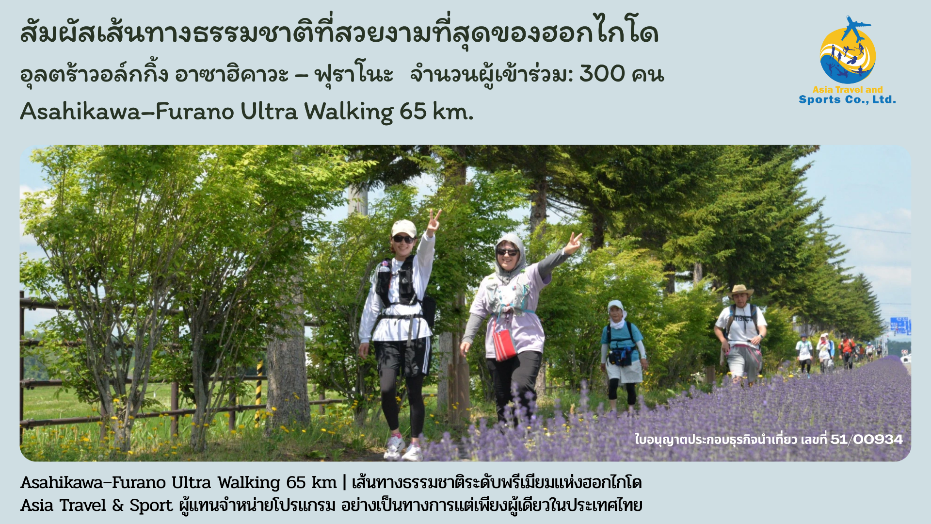
- Lavender Fields: Purple-hued fields of Furano and Nakafurano
- Mountain Views: Mt. Asahidake and Tokachi mountain range panoramas
- Sunset Finish: Beautiful evening light over the Yubari Mountains
Personal Challenge & Achievement
- Test your physical endurance over 65km
- Build mental strength through challenging terrain
- Achieve a meaningful personal milestone
- Receive certificate of completion (no ranking awards)
Community & Camaraderie
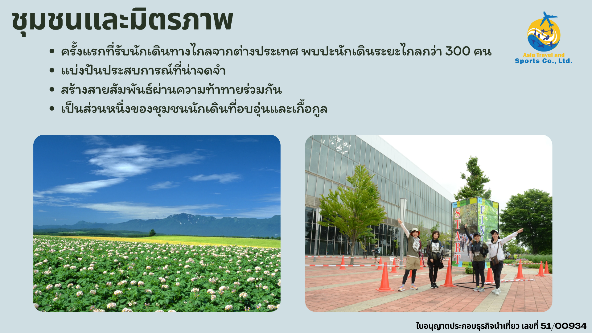
- Connect with 300 fellow walking enthusiasts
- Share unforgettable experiences
- Create lasting bonds through shared challenge
- Join a supportive walking community

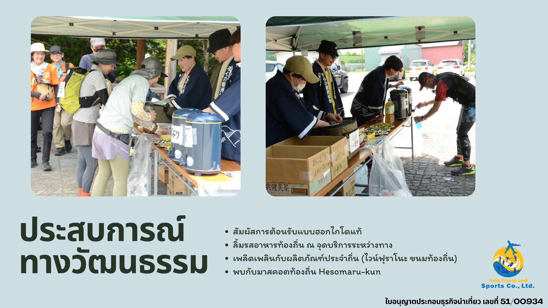
- Experience authentic Hokkaido hospitality
- Taste local specialties at aid stations
- Enjoy regional products (Furano Wine, local sweets)
- Meet local mascot Hesomaru-kun
Registration Information
Capacity: 300 participants (first-come, first-served)
Fee: 11,700 yen (subject to change—verify before registration)
Included: Participation gift, accident insurance, aid station refreshments, completion certificate
Important: No refunds after registration is accepted
Join the Challenge: Are You Ready?
The Lavender Road Ultra Walking offers more than just a physical challenge—it's an opportunity to experience Hokkaido's natural beauty, test your limits, and create unforgettable memories. Whether you're an experienced ultra walker or embarking on your first long-distance challenge, the stunning landscapes of Asahikawa, Biei, and Furano await.
Mark your calendar: June 27, 2026
Limited to 300 participants—register early!
Experience the perfect blend of physical achievement, natural beauty, and cultural immersion. Challenge yourself on the Lavender Road and discover why Hokkaido captures the hearts of walkers from around the world.

Contact & Entry for International Participants
Official Event Organizer
We are an executive event organizer officially authorized by the Japan Ultra Walking Association. Our local operations are registered with the Hokkaido Prefectural Government as a licensed land operator, ensuring professional and reliable service for all participants.

Frequently Asked Questions
Q: Is this a race or a walk?
A: This is a non-competitive walking event. There are no ranking awards, only certificates of completion. The focus is on personal achievement and enjoying the scenery.
Q: What if I can't complete the 65km?
A: Checkpoints along the route have cutoff times. If you cannot meet these times, you'll need to withdraw. Transportation will be provided for those who don't finish.
Q: Are there accommodations near the start/finish?
A: Yes, both Asahikawa and Furano offer various hotels and guesthouses. Book early as this is peak tourist season.
Q: Can I participate if I've never done an ultra walking event?
A: While prior experience helps, determined beginners with proper training can complete the course. The 13.5-hour time limit allows for a moderate pace with breaks.
Q: What happens in bad weather?
A: The event proceeds rain or shine unless conditions are deemed dangerous. Prepare appropriate rain gear and weather protection.
Q: Best Time to Visit Hokkaido for This Event
Late June is ideal for experiencing Hokkaido's lavender season. The lavender fields of Furano and Nakafurano are typically in early bloom, offering spectacular purple landscapes. Weather is generally mild but prepare for variable conditions.
June in Hokkaido
- Average temperature: 15-20°C (59-68°F)
- Long daylight hours (sunrise ~4:00 AM, sunset ~7:00 PM)
- Lavender season beginning
- Pleasant walking weather with lower humidity
Q: How to Get There
By Air
Asahikawa Airport (Hokkaido's second gateway)
- Direct flights from Tokyo (Haneda/Narita), Osaka, Nagoya
- Approximately 30 minutes to Asahikawa city center by bus
By Train
JR Asahikawa Station (Event start)
- Express train from Sapporo: ~1.5 hours
- Limited express from New Chitose Airport: ~2 hours
JR Furano Station (Event finish)
- Return to Asahikawa: ~1 hour by local train
- Bus services available to major cities
About the Lavender Road Region


